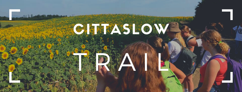
Cittaslow Trail
FOLLOW US ON FACEBOOK - CLICK HERE
TAKE A HIKE!
The best walking vacations around the world in the Cittaslow’s most beautiful areas
Hiking on the footpaths and healthy holidays are every day more popular than ever before. Hiking, trekking, the paths along the ancient roads, Nordic walking, skyrunning, biking, horseback riding, are all included on the “meditation trips”, as well yoga retreats, in contact to natural elements. All these outdoor activities are perfectly consistent with Cittaslow's principles and values: time to get your boots on! Slowly.
Today Cittaslow offers two new tools to easily find the best itineraries and travel opportunities in the network of over 270 cities around the world
BELGIUM
SILLY
- Strawberries Walking Tour - Download trail card
- Strawberries Bike Tour - Download trail card
- Castel and Wood Walk - Download trail card
- Thoricourt Walk - Download trail card
- Prince’s Walk - Download trail card
- Saint-Marcoult’s Maquis Walk - Download trail card
- Bassilly-Hellebecq Walk - Download trail card
- Fields and Woods Walk in Graty - Download trail card
- Open landscapes and old farms Walk in Hoves - Download trail card
- Green escape in Silly (Bike 16km) - Download trail card
- Green escape in Silly (Bike 21km) - Download trail card
- Course of the Sille (Mountain Bike) - Download trail card
---
FRANCE
CAZAUBON
- La Route de l'Armagnac - Download
- Les Vignobles de Castelnau d'Auzan - Download
- Le Lac de l'Ulby - Download
- Tavernes et le Marais - Download
- Circui du Tuco - Download
- Le GR65 - Download
- Voie verte du marsan et de l'Armagnac - Download
Info: www.grand-armagnac.com
LABASTIDE D'ARMAGNAC
- A Labastide d'Armagnac, faites la ronde des châteaux
- A Saint Justin, flânez de bastide en airial
- A Hontanx, balade entre coteaux et étangs
- A Saint Justin, flânez de bastide en airial
---
GERMANY
BAD WIMPFEM
- Stroll through Kaiserpfalz Bad Wimpfen - Download PDF
BISCHOFSHEIM
- Extratour kreuzbergtour - Link
WALDKIRK
- The ZweiTälerSteig Trail - Link - PDF (English) - Flyer PDF - Flyer Jpg
DEIDESHEIM
- Hiking through Palatine - Download PDF
---
ITALY
- Sentiero Italia - Link
ACQUAPENDENTE
- Trail flower - Download PDF
CISTERNINO
- Monti Comunali Trail - Download PDF
- Marinelli Trail - Download PDF
- Monte Castel Pganao Trail - Download PDF
- From Monte Pizzuto to Geological site - Download PDF
- Monte Specchia Cirasuolo Trail - Download PDF
CHIAVENNA
- Via Spluga Slow - Image
- Via Spluga Con Gusto - Image
- A spasso tra i borghi - Image
- Bike Valchiavenna
MORIMONDO
- La via Francisca del Lucomagno - Download trail card
SALORNO
- Bike excursions - Download trail card
- Excursions Bassa Atesina - Download trail card
- Pinot Nero Trail - Download trail card
SANT'ARCANGELO DI ROMAGNA
- Valmarecchia - Link
SAN VINCENZO
- Excursions Volterra a Piombino - Google maps
- Excursions "Il Ginepro" (ippovia, trekking, mountain bike) - Google maps
- Excursions "Il Corbezzolo" (ippovia, trekking, mountain bike) - Google maps
TRAVACÒ SICCOMARIO
- Route 1, (orange color) Discovering the whole Siccomario
Km 29, duration: bike 2 hours 30, walking 6 hours (medium difficulty)
A way to discover all that the Siccomario offers, between history, nature and culture.
A path that allows you to see the historic Lombard farms, to know the history of a territory shaped by the will of the rivers and at the same time by the possibility of making pleasant encounters, with a squirrel or a fallow deer.
GPX track link: KML: Download - GoogleMaps URL
- Route 2 (purple color) The circuit of the banks through history
Km 22, duration: bike 1 hour and 50, on foot 2 hours and 30 (medium difficulty)
A path through the '700 embankments which for centuries have protected the siccomario from the impetuosity of the waters of the rivers, pleasantly discovering the historic buildings along the way
GPX link: KML Download - GoogleMaps URL
- Route 3 (green color) the ancient Via Francigena del Siccomario
Km 10 duration; bike 50 min, walk 1 hour 45
A path designed to retrace the branch of the Via Francigena that crossed the Siccomario,
GPX link: KML Download - GoogleMaps URL
- Route 4 (blue color) The circuit of nautical routes and the large forest
Km 23, duration: bike 1 hour and 50, on foot 2 hours and 30
The circuit allows you to get to know all the naturalistic routes and places of the Siccomario, such as the naturalistic route along the Rotta river, or the large forest, a unique environment that presents different animal species and all the native species of the place.
GPX link: KML Download - GoogleMaps URL
TREVI
- Spoleto Assisi bicycle lane - Download PDF
- The Way of San Francesco - Download PDF
- Trail of Olives (from Spoleto to Assisi) - Download PDF
---
NETHERLANDS
ALPHEN-CHAAM
- Outdoor Itineraries - Download PDF
BORGER-ODOORN
- Leewal walk
This hike of 7.5 kilometres will take you through forests and over heaths and sand dunes, along hunebeds and fields between the old towns of Exloo and Odoorn, and you will travel through 470.000 years of history. You will see impressive remains from the ice ages, such as large erratic boulders and the enigmatic Leewal that curves through the landscape.
There is an app available that will provide you with information about the Hondsrug area. It includes movies and animations, so you can experience the history from close-up. You’ll receive information about the origin of the hills and the dry valleys, about the Mammoths and Sabre-toothed tigers that once roamed this area.
Stay on the path and follow the trail of the mammoth. https://www.dehondsrug.nl/routes/leewal-walk-through-time/?lang=en - Sabre-toothed tiger trail for adventurous kids
In the fairy-tale-like forest of the Hunzebos you can find the trail of the Sabre-toothed tiger, a playful hike of about 2 kilometers for fearless kids. The trail winds through the forest and over the ice-age hills. You’ll climb, swing on ropes, balance on rickety bridges, swoosh downhill on a cable runway and much more.
Along the way you can play exciting games using the app and test your speed and skills against that of the Sabre-toothed tiger. And you’ll learn about the impressive Mammoth that once lived here. https://www.dehondsrug.nl/routes/sabre-toothed-tiger-trail/?lang=en
---
POLAND
BARCZEWO
- Barczewo-Zalesie Trial - Download PDF
BISKUPIEK
- Along the trail of history - Download PDF 1 - Downaload PDF 2 - Text
GOŁDAP
- Trial "The trakcs of Deer" - Download PDF - Brochure - Google Maps
NOWE MIASTO LUBAWSKIE
- Camino de Santiago | Camino Polaco - GoogleMaps - Text - Ph 1 - Ph 2 - Ph 3
- Kayak Trail - Text - Flyer - Photo
PRUDNIK
RYN
- Path around the “Ołów” lake - Download PDF - Maps - Photo
---
SPAIN
TAVIRA
- Via Algarviana - Estabelece a ligação pedestre entre Alcoutim e o Cabo São Vicente (Sagres). Possui uma extensão de 240 quilómetros, maioritariamente na serra algarvia, atravessando nove concelhos e vinte e uma freguesias. No concelho de Tavira, atravessa a freguesia de Cachopo, situada em plena serra do Caldeirão. Para mais informações: http://www.viaalgarviana.org/
- EcoVia - A Ecovia percorre todo o litoral do Algarve, numa extensão de 214 quilómetros, desde do Cabo São Vicente (Vila do Bispo) até Vila Real de Santo António, atravessando doze concelhos.
- O percurso do concelho de Tavira é bastante diversificado, poderá desfrutar da beleza da cidade histórica, da Ria Formosa, com as suas espécies de grande valor ambiental, salinas, sapais, fortes, barcos… O traçado encontra-se identificado no portal online GPSies e no sistema de mapas interativos do Município de Tavira.
- Percursos pedestres - Permite (re)descobrir a serra e as suas paisagens, cores, gente simpática, saberes locais através dos percursos pedestres que a Associação In Loco desenvolveu nas freguesias de Cachopo e de Santa Catarina da Fonte do Bispo. Para mais informações: http://www.in-loco.pt/pt/percursos-pedestres/#1168.0625
- Câmara Municipal de Tavira disponibiliza igualmente um variado conjunto de percursos turísticos, os quais estão em formato papel (os ficheiros serão enviados posteriormente por wetransfer) e audioguias (http://www.cm-tavira.pt/site/node/520). Cada percurso é acompanhado de uma breve descrição histórica e patrimonial. - DOWNLOAD DISCOVER TAVIRA GUIDE EN - DOWNLOAD DISCOVER TAVIRA GUIDE PT - DOWNLOAD DISCOVER TAVIRA GUIDE EP - DOWNLOAD DISCOVER TAVIRA GUIDE FR